The cold hit first.
Not as a gentle reminder of winter, but as that sharp, metallic air that bites your lungs when you leave the house too fast. Across much of the Northern Hemisphere, people have been zipping up thicker coats again just as they were starting to dream of spring. Weather apps keep redrawing their 10‑day outlooks. Forecasters are posting late‑night threads on X, nervously excited.
High above all this, in a layer of sky most of us never think about, the stratosphere is quietly flipping the script. A rare, early‑season warming is spreading there like a slow‑motion shockwave.
Down here, the question is simple.
What happens next?

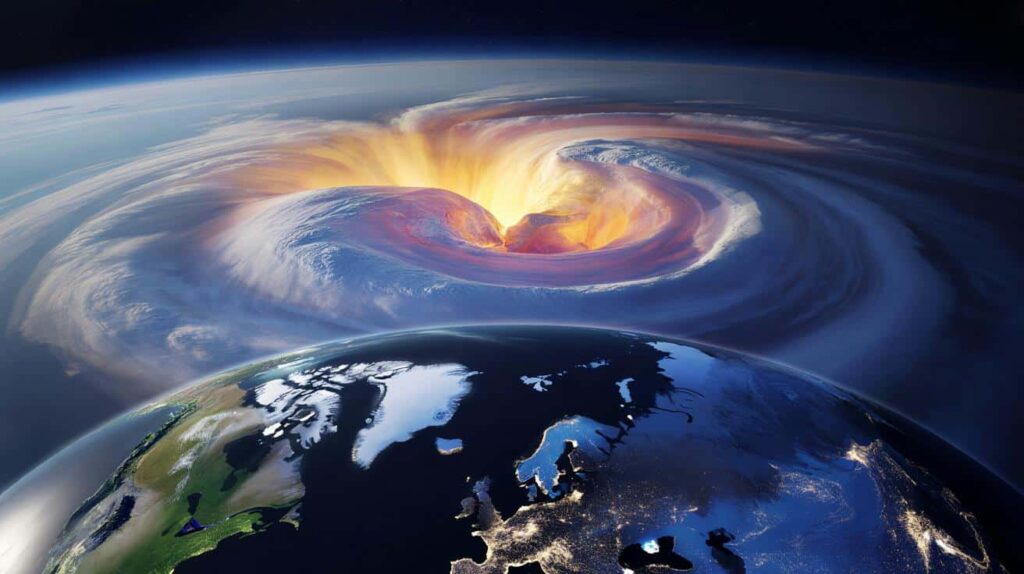
A heat wave where the sun barely shines
Right now, about 30 to 50 kilometers above your head, the air is doing something that feels almost upside down. The stratosphere over the Arctic, usually brutally cold in February, is suddenly warming by tens of degrees in just a few days. It’s called a **sudden stratospheric warming** event, and when it shows up this early and this strong, meteorologists sit up straighter in their chairs.
On the maps in forecasting centers, the familiar tight ring of polar winds is breaking apart. Colors that should be deep blue are flushing yellow and red. Down at ground level the sky looks “normal,” yet the stage for the rest of winter is being rewritten in silence.
If this sounds abstract, think back to the beastly late-winter cold snaps of 2018 in Europe or the brutal US freeze in February 2021. Both were linked to disrupted polar vortices, those spinning rings of westerly winds that usually trap the cold near the pole. During major stratospheric warmings, that vortex can weaken, tilt, or even split into two lobes.
In 2018, that helped unleash frigid Arctic air deep into Western Europe while parts of the Arctic turned oddly mild. In 2021, Texas saw frozen pipes and rolling blackouts as temperatures crashed far below seasonal norms. The atmosphere is huge and messy, but events like those are why scientists are watching February 2026 so closely.
What’s unusual now isn’t just that a warming is happening. It’s the timing and possible intensity. Early‑season events, hitting before late February, have more time to “communicate” with the layers below and reshape weather patterns for weeks.
Meteorologists talk in careful probabilities, not bold promises, yet the signals are clear enough that winter forecasts are being re‑drawn in real time. *A kind of meteorological butterfly effect is unfolding over the Arctic, and the ripples may soon be felt in your backyard.* The science is still being written, and so is the forecast on your phone.
How a warm stratosphere can freeze your street
So what does this mysterious warming actually do to our day‑to‑day weather? The short version: when the polar vortex is punched by these warming events, its normally tight circulation can unravel. That distortion often encourages “blocking” patterns in the jet stream, those big, wavy loops that decide who gets stuck in cold and who basks in mild spells.
For mid‑latitudes, that can mean colder, snowier conditions in late winter for parts of North America, Europe, and Asia, while some regions turn oddly mild and storm tracks twist in unexpected directions. Your favorite winter forecast model suddenly looks less confident, because the rules on the board have changed.
Imagine you’re planning a mid‑February city break in Berlin or Chicago. A week ago, long‑range guidance might have hinted at a gentle slide toward spring, with chilly but manageable days and wet, slushy streets. As the stratospheric warming amplifies, new runs start showing deeper troughs of cold digging south, pressure systems parking for longer, and the odds of late‑season snowfall ticking upward.
For energy grids, that difference is huge. A 3–5°C swing in average temperature over a week can send gas demand surging, while wind and solar outputs also shift. Ski resorts that had almost given up on the season could suddenly be looking at a profitable last act. The same map, a very different story.

Scientists break it down like this: the warming disrupts the strong high‑altitude westerlies, the polar vortex wobbles, and wave patterns in the atmosphere can more easily propagate downward. Over about 10–14 days, those disturbances can “couple” with the troposphere, the layer where our weather lives.
Not every sudden stratospheric warming translates into a blockbuster cold spell. Some fizzle, some shift the storm tracks far from where people are watching. Yet the odds of unusual patterns increase sharply, and that’s why **long‑range winter outlooks are being revisited in labs and newsrooms right now**. Forecasts aren’t broken; the atmosphere just changed the exam halfway through the test.
How to read the sky like the pros (without losing your mind)
If you’re not a meteorologist, all this talk of polar vortices and stratospheric coupling can sound like a different language. There’s a simpler way to navigate it. Start by following three kinds of updates: official meteorological agencies, reputable long‑range forecasters, and local weather offices. Each sees a different slice of the same story.
When you hear “sudden stratospheric warming” in their reports, don’t panic. Treat it as an early warning that patterns may shift two to three weeks down the line. That’s your cue to watch for changes in wording: “increased risk,” “colder-than-average potential,” “enhanced chance of blocking.” Those little phrases are where the real guidance lives.
Many of us fall into the same trap: we screenshot a dramatic model run from social media, send it to friends, and treat it as destiny. Then the atmosphere does what it always does and veers slightly left. We’ve all been there, that moment when the “historic snowstorm” becomes a slushy non‑event and the memes begin.
The kindest thing you can do for yourself is think in ranges, not absolutes. Look at temperature anomalies instead of single numbers. Notice trends over several days instead of obsessing over one dramatic chart. Let’s be honest: nobody really reads the fine print on model reliability, yet that boring line of text is often the wisest part of the whole forecast.
This is also a good time to listen for nuance in expert voices. When scientists talk about this February’s warming, they’re weighing not just the event itself, but background climate factors, ocean temperatures, and how previous winters with similar setups behaved.
“People hear ‘polar vortex’ and think of an instant freezer descending on their house,” says one senior climate scientist at a European research center. “What we’re really talking about is a higher chance of the jet stream misbehaving. That can mean harsh cold, but it can also mean strange warmth and stalled storms in odd places.”
- Track updates from your national meteorological service before trusting viral model maps.
- Plan flexible travel and outdoor events in late February and early March, not rigid, weather‑sensitive schedules.
- Review home and energy prep: insulation, backup heat, and smart thermostat settings if colder outbreaks materialize.
- For businesses, stress‑test logistics for both deep cold and disruptive storms, especially in energy, transport, and retail.
- Stay curious, not fearful: treat this as a live science lesson happening right above you.
A winter still being written above our heads
This rare early‑season stratospheric warming is a reminder that winter isn’t locked in by the calendar or the first daffodils poking through the soil. The atmosphere remains gloriously unruly. One month can feel like April, the next like January’s grumpy return. For forecasters, that’s both a nightmare and a thrill, the kind of pattern that tests every tool they’ve built over decades.
For the rest of us, it’s a nudge to rethink what a “normal winter” even means. As climate change shifts the background conditions, these extreme swings sit on top of a warming baseline, making the weather feel weirdly out of sync with the stories we grew up with. Snow days come later, cold spells are shorter but sharper, and events like this February’s warming gain new weight.
Some will scroll past the headlines and shrug. Others will start quietly adjusting plans, watching their local forecast evolve day by day. This might be one of those winters we look back on and say, “That was the year I really started paying attention to the sky again.”
| Key point | Detail | Value for the reader |
|---|---|---|
| Stratospheric warming reshapes patterns | February’s strong event can disrupt the polar vortex and jet stream for weeks | Helps readers understand why forecasts are suddenly changing |
| Impacts are delayed and uneven | Weather effects often appear 10–21 days later and vary by region | Encourages realistic expectations instead of instant panic or hype |
| Smart monitoring beats doom‑scrolling | Following official updates and trends is more useful than single viral maps | Gives practical habits for planning travel, energy use, and daily life |
FAQ:
- Question 1What exactly is a sudden stratospheric warming event?
- Question 2Does a stratospheric warming always mean a big freeze where I live?
- Question 3When could I start to notice the effects of this February event?
- Question 4How is this linked to climate change, if at all?
- Question 5What’s the most sensible way to plan around this kind of forecast uncertainty?