The first clue something was off this winter wasn’t a headline.
It was that weird, almost guilty feeling you get stepping outside in February and realizing… you’re not freezing. Trees budding too early. Mud instead of snow. Kids biking in hoodies while your phone quietly pings one more “unseasonably warm” notification.
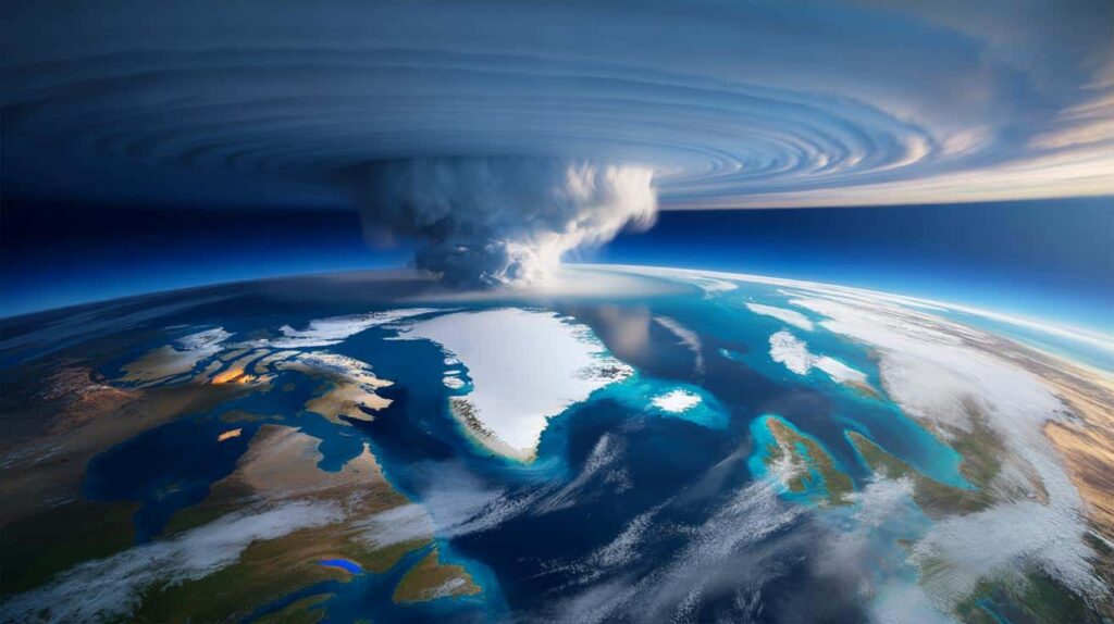
High above all of that, around 30 km over the North Pole, a massive invisible engine of cold air is starting to wobble and twist. Meteorologists say this year’s disruption of the polar vortex isn’t just unusual for February – it’s among the strongest they’ve seen so far this century.
Down here on the ground, that could translate into a hard atmospheric plot twist.
One that arrives late, and hits fast.

A polar vortex disruption that doesn’t fit the script
Most winters, the polar vortex is like a tight, spinning crown of cold air locked over the Arctic.
It keeps the worst of the frigid air penned in, circulating quietly in the stratosphere while we go about our lives below.
This year, that crown is cracking.
A violent warming event high in the atmosphere is tearing into the vortex, slowing its spin and bending its shape in ways that models are flagging as “exceptionally strong” for February. Scientists call this a sudden stratospheric warming, or SSW.
For people on the ground, the jargon doesn’t matter as much as the outcome.
When the vortex buckles, Arctic air doesn’t stay polite.
If you were in North America or Europe during the brutal cold blasts of 2013, 2018 or early 2021, you’ve already lived the downstream effects of a disrupted vortex.
Those were winters when -20°C showed up where -5°C used to be “extreme,” when Texas saw snow and frozen pipes, and when Londoners went from damp drizzle to “Beast from the East” headlines overnight.
This time, forecasters are staring at an odd timing mismatch.
Instead of the classic mid-January hit, this disruption is peaking deep into February, a phase when retailers have already rolled out garden furniture and allergy ads. Early model runs show the vortex splitting and lurching southward, with lobes of cold air potentially angling toward North America, Europe, and parts of Asia in the coming weeks.
It’s like winter missed its cue, walked offstage, then decided to stroll back in for an unscheduled encore.
So what makes this year’s event so intense?
The numbers tell a blunt story. Stratospheric temperatures over the polar cap have spiked by tens of degrees in just days – not enough to feel at the surface yet, but enough to tear into the vortex’s circulation. Wind speeds that usually scream eastward at over 150 mph have slowed, stalled, and in some layers flipped direction.
That reversal is a hallmark of a major SSW, the kind you see maybe once every few years.
Climate researchers are still debating how global warming is nudging these disruptions – whether we get them more often, or just differently – but they broadly agree on one thing: **when the vortex loses its grip, weather patterns become more chaotic and more persistent.**
That’s the quiet reason so many experts are suddenly paying attention.
What you can actually do while the atmosphere does somersaults
On the personal level, there’s no knob you can turn to calm a broken jet stream.
What you can do is approach the next few weeks less like normal winter, and more like a season with a jump scare built in.
Treat your weather app the way you’d treat a banking app during a data breach.
Check it more often. Scan not just for temperature, but for wind direction, wind chill, and the dreaded “feels like.” Look at the 5–10 day trend, not just tomorrow’s snapshot.
That simple habit shift – from casual glance to quick scan – is often the difference between “huh, that’s chilly” and “why are my pipes making that sound?”
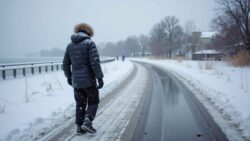
We’ve all been there, that moment when you’ve already packed away the heavy coat and suddenly a late freeze bites into your morning commute.
This year, that’s not just a mild inconvenience; it’s a realistic scenario tied to a very real atmospheric event.
The trap is emotional, not just practical. Warm spells lull us. We cancel chimney inspections, delay tire swaps, skip the boring stuff like checking insulation around outdoor faucets. Then a polar vortex lobe slides south and social feeds fill with pictures of burst pipes and iced-over highways.
Let’s be honest: nobody really does this every single day.
Still, even one weekend of “boring prep” – sealing drafts, knowing where your water shutoff valve is, rotating emergency supplies that quietly expired in 2020 – can blunt the shock of a late-season cold punch.
Meteorologists themselves are walking a tightrope between caution and alarm.
They know not every strong SSW translates into a Siberian-style winter for everyone, yet this one is strong enough that they’re speaking more plainly than usual.
“From a dynamical standpoint, this is one of the more robust February disruptions we’ve seen in the reanalysis record,” says Dr. Amy Butler, a polar vortex specialist with NOAA. “The odds of downstream cold outbreaks over the next few weeks are elevated. The exact who-and-where is still evolving, but this isn’t a background blip – it’s a major atmospheric event.”
To turn that into something practical, it helps to box the noise into a few simple priorities:
- Watch regional forecasts, not just national headlines – your local impacts depend on jet stream wiggles.
- Think in scenarios: short sharp cold snap vs. multi-week pattern change.
- Protect the basics first: heat, water, medication, and a way to get accurate information if the power flickers.
*The science is complex, but your response doesn’t have to be.*
A late-winter plot twist that says a lot about our climate story
What’s happening above the Arctic right now is both a weather story and a climate story, and it resists tidy endings.
If the models are right, some regions will get a whiplash reminder that winter isn’t done with us just because the calendar says so. Others might watch the whole disruption unfold mostly as a curiosity on weather Twitter.
Yet the pattern itself feels like a preview of the decades ahead: stranger timing, sharper contrasts, more winters that are mostly mild until, suddenly, they’re not. **That creeping instability is the real headline behind this year’s exceptionally strong February vortex disruption.**
You don’t need to become an amateur meteorologist to navigate it.
You do need to stay just curious enough to notice when the background systems – the ones we rarely think about, like the stratospheric winds humming over the pole – start to wobble.
The atmosphere is sending a late, loud signal this year.
How we listen, adapt, and talk about it with each other may matter almost as much as the cold that eventually reaches our streets.
| Key point | Detail | Value for the reader |
|---|---|---|
| February vortex disruption is unusually strong | Major sudden stratospheric warming with wind reversal and vortex splitting | Signals higher odds of late-season cold snaps and pattern changes |
| Impacts will be uneven and delayed | Cold air lobes may hit North America, Europe, or Asia over several weeks | Encourages checking regional forecasts instead of relying on broad headlines |
| Simple prep beats panic | Monitor trends, protect home basics, plan for short sharp bursts of cold | Reduces stress, damage risk, and last-minute scrambling if winter roars back |
FAQ:
- Question 1What exactly is the polar vortex, and should I be scared of it?
- Answer 1The polar vortex is a large circulation of very cold air high above the Arctic, normally contained in the stratosphere. It’s not a storm or a single event, and it’s been there long before we named it. You don’t need to fear the vortex itself, but when it weakens or breaks apart, outbreaks of Arctic air can dive south and bring harsh, sometimes dangerous, cold.
- Question 2When could this February disruption affect weather where I live?
- Answer 2Surface impacts from a sudden stratospheric warming usually lag by 1–3 weeks. That means late February into March is the key window. Exact timing and intensity depend on where you are and how the jet stream responds, which is why local forecasts over the next 10–20 days matter more than any single viral map.
- Question 3Does a strong polar vortex disruption always mean extreme cold?
- Answer 3No. A major disruption tilts the odds toward cold outbreaks in certain regions, especially mid-latitudes, but it doesn’t guarantee a deep freeze everywhere. Some areas may stay relatively mild or just see a brief chill. The real shift is in probabilities and patterns, not in an automatic “doom cold” switch.
- Question 4Is climate change causing these disruptions to get worse?
- Answer 4The science is still evolving. Some studies suggest that a warming Arctic and shrinking sea ice can destabilize the polar vortex more often, leading to more mid-latitude cold events, while others find weaker links. What most researchers agree on is that a warming background climate is stacking the deck for more unusual, less predictable patterns overall.
- Question 5What’s the smartest thing I can do this week in response?
- Answer 5Take one focused hour: review your local 10-day forecast, check your home’s basic winter defenses (heating, pipes, drafty spots), and refresh a simple cold-weather kit: warm layers, batteries, flashlights, and key medications. Then keep a casual eye on updates from trusted meteorologists instead of doomscrolling every dramatic map.