The satellite image looked almost fake at first. A long, pale streak in the open Pacific, rising from an otherwise flat blue emptiness, like a scar across the water. In a control room in Darmstadt, a tired technician zoomed in, rubbed his eyes, then quietly called a supervisor. Within minutes, a small cluster of oceanographers had gathered around the screen, coffee cups in hand, talking over each other in low, excited voices.
Out there, thousands of kilometers from any coast, the numbers said something crazy: waves higher than a ten-story building were rolling through the dark.
Something the textbooks had quietly filed under “rare curiosity” was suddenly very real.
Satellites catch a monster wave in the act
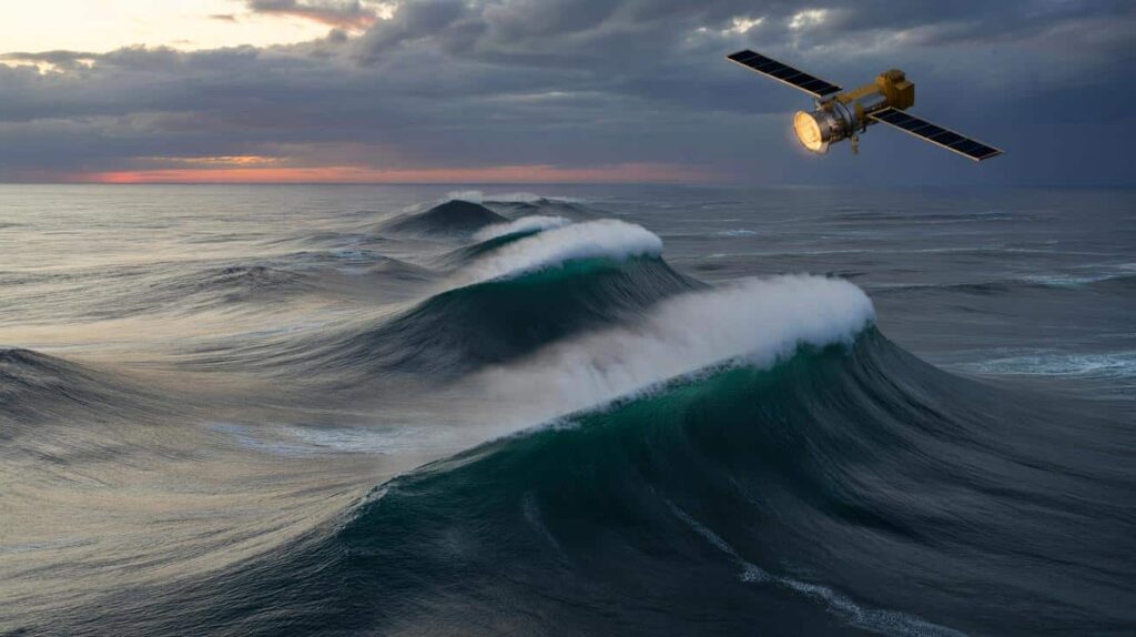
On the open ocean, most waves look like ripples from space. Even big swells blur into gentle textures when you’re staring down from 800 kilometers above. So when a European Sentinel satellite flagged an anomaly in the central Pacific this winter, the algorithm didn’t just ping – it practically shouted.

Radar altimeters, the instruments that “feel” the height of the sea surface, recorded peaks brushing 35 meters. That’s roughly the height of a flipping twelve-story apartment block, rising and collapsing over deep water, again and again, far from any storm you’d see on the evening weather map.
One of the scientists who saw the data first, a French physical oceanographer, later described the moment to a colleague. It was just after 3 a.m., the kind of shift where you mostly expect boredom and routine checks. Then the feed pushed through a cluster of sharp, needle-like spikes.
He pulled historical files to compare. “We had strong storms, El Niño years, freak gales off Japan,” he explained, “but this didn’t fit.” The wave field looked tight, almost focused, sitting in the middle of a region that, on the surface, seemed relatively calm. *The word that kept coming up on the internal chat was simple and slightly childish: ‘monstrous’.*
Once the shock settled, the deeper questions started. Extreme waves aren’t new to science, but they’ve long sat in that uneasy space between sailor legends and scattered measurements. Satellite constellations have changed that game.
By scanning the same patch of ocean again and again, they can piece together how different swells cross paths, how wind fields stack energy, how currents bend and amplify it. What stunned the team wasn’t just a single 35-metre crest. It was the pattern suggesting that under certain large-scale conditions, the Pacific can quietly assemble these giants more often than ships’ logs have ever admitted.
How a random sea turns into a vertical wall of water
Behind the poetic term “rogue wave” lies something brutally geometric. Picture dozens of wave trains traveling in slightly different directions, at slightly different speeds. Most of the time they pass through each other, cancelling here, adding there, leaving a confused but manageable chop. Then, once in a while, the timing clicks. Peaks line up with peaks, troughs with troughs, and the sea suddenly decides to throw all its energy into one place.
From orbit, satellites don’t see drama, they see math. But those radar echoes told a story of perfect, dangerous alignment.
Ship captains have always talked about “the one that came out of nowhere”. A container vessel in the North Pacific reported a 30-metre hit in the 1990s that smashed the bridge windows 20 meters above the waterline. The crew swore the sea had been rough but not insane until that single wall reared up. At the time, many scientists nodded politely and filed it under “possible exaggeration”.
Today, with global altimeter records building up over decades, those stories land differently. Archives show spikes – sharp, isolated towers of water – scattered across oceans, from the South Atlantic to the Southern Ocean. The fresh 35-metre Pacific detection drops right into that growing constellation of scars.
So what’s different now? Part of the answer is resolution. Older satellites gave a blurry, averaged-out sea. Newer missions like Sentinel and Jason are much more sensitive, able to pick out local peaks instead of smoothing them into polite averages. Then there’s climate. Warmer oceans, shifting wind belts, and more energetic storms reorganize how and where waves trade energy.
Oceanographers don’t like to cry “new normal” lightly, but the numbers are nudging them in that direction. **If you zoom out, you don’t just see isolated freaks – you see the dice of the ocean being quietly loaded toward the extreme face.**
Why this matters far from the nearest coast
For most of us, these 35-metre waves feel abstract. We’re not out there on cargo ships or research vessels, staring up at black-green walls of water. Yet the way scientists now work with these satellites has a very practical rhythm. They’re feeding real-time wave data into forecasting models, adjusting risk maps, testing how hulls might behave when hit at ugly angles.

That might sound like distant engineering talk, but behind it is a simple aim: stop losing ships, cargo, and people to something we once wrote off as maritime folklore.
There’s also the more human side: the quiet margin of error every sailor carries in the back of their mind. For offshore crews, oil platform workers, or scientists deploying instruments in the middle of nowhere, these satellite alerts are becoming a second pair of eyes. They can choose routes that avoid the worst intersections of swell and current, delay work windows when the models whisper “bad timing”.
We’ve all been there, that moment when you underestimate nature because yesterday went fine. Out at sea, that small lapse can cost millions in gear and, sometimes, lives. Let’s be honest: nobody really reads a full marine forecast bulletin line by line every single day.
One ocean engineer I spoke to put it in stark, almost blunt terms.
“Rogue waves were treated as maybes,” he said. “Now, satellites are turning them into numbers we can’t argue with. And when you can’t argue, you have to redesign.”
Around those numbers, a new mental checklist is quietly forming for anyone who thinks about the sea professionally:
- Rethink ship routes that cross major swell highways in winter.
- Stress‑test offshore structures for not just ‘average storms’ but single‑hit extremes.
- Update training drills so crews know what to expect when a ‘once-in-10,000’ wave isn’t so rare anymore.
- Watch how climate-driven shifts in wind belts might move these hotspots over the coming decades.
Each bullet sounds technical on paper. On deck, under freezing spray at 3 a.m., they translate to something very simple: getting home in one piece.
The quiet unease behind a spectacular image
The photo that will probably go viral isn’t really a photo. It’s a false-color rendering of sea-surface height, glowing like a weather map from the future: cool blues, gentle greens, then those violent reds where the wave crests spike skyward. It looks almost artistic, something you’d print big and hang on a lab wall.
Yet once you know what those colors mean – steel decks buckling, containers twisting off into the dark, navigation systems briefly useless – that beauty starts to itch a little.
For coastal people, the mind jumps quickly: if we’re seeing 35-metre waves offshore, what happens when that energy marches landward? The truth is, nearshore physics are different, and not every deep-water giant survives the trip. Still, these detections feed into our broader picture of how the ocean stores and releases energy, how storm swells might interact with already raised sea levels, how erosion lines might inch inland more often.
Scientists are cautious by training, almost allergic to hyperbole. Yet in private conversations, there’s a shared sense that the ocean is speaking a little louder than before.
There’s also a kind of humbling intimacy to this story. A machine orbiting high above picks up a fleeting surge on water we will never touch, in a place no tourist cruise will ever go. A handful of people in dim rooms read the squiggles, send a few emails, tweak a line in a model. And slowly, policy, design standards, even insurance tables shift.
**These colossal waves may be born in the loneliest reaches of the Pacific, but their shadow falls across shipyards, ports, and boardrooms on every continent.** How you feel about that depends on your relationship with risk, and with the sea. For some, it’s a reason to fear. For others, it’s a nudge to respect, adapt, and keep listening to what the satellites quietly keep telling us.
| Key point | Detail | Value for the reader |
|---|---|---|
| Satellites confirm 35 m waves | New-generation radar altimeters detect extreme crests in the central Pacific | Turns “sailor stories” into measurable reality |
| Extreme waves are becoming better mapped | Decades of global data reveal recurring rogue-wave hotspots | Improves forecasting, routing, and safety at sea |
| Design standards are shifting | Ships and offshore structures are being reassessed against single-hit extremes | Reduces hidden risk for trade, energy, and coastal communities |
FAQ:
- Are 35-metre ocean waves really possible?Yes. Satellite altimeters and a few direct buoy and platform measurements have confirmed waves over 25–30 m, with rare events now reaching around 35 m under very specific conditions.
- Do these giant waves hit beaches?Not usually in their original form. Deep-water rogue waves tend to form and collapse offshore, though the same storm systems can send powerful swells that raise coastal flood and erosion risks.
- Are rogue waves caused by climate change?Rogue waves themselves are a natural interference phenomenon, but changing wind patterns and storm tracks linked to climate warming may alter where and how often the extremes occur.
- Can ships survive a 35-metre wave?Some can, depending on angle, speed, and design, but impacts at that scale can damage superstructures, windows, and cargo, and in worst cases contribute to catastrophic failures.
- How do satellites measure wave height from space?They use radar altimeters, which send pulses down to the sea surface and time their return; by analyzing the distribution of returned signals, they estimate significant wave height and identify extreme crests.